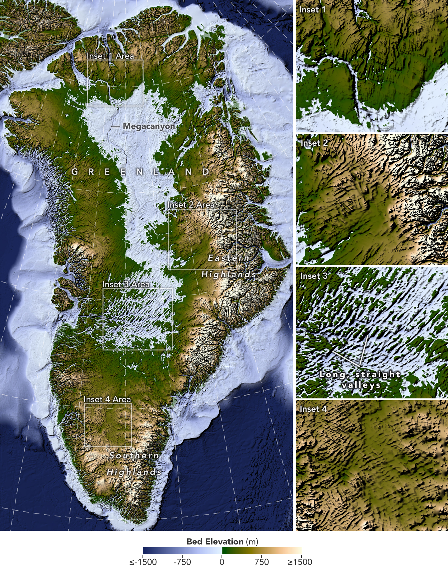
On 28 September, NASA’s Earth Observatory published a new map of the bedrock buried beneath the Greenland Ice Sheet, which is more than 3 km thick in places. It draws on a study in Geophysical Research Letters (online since 30 June), which infers the shape of the ground from the subtle undulations it imprints on the surface of the ice, mapped by satellite.
The researchers charted 1,943 subglacial valleys, about a third of which were previously unknown; this work is meant to help improve BedMachine Greenland, the reference map of the terrain beneath the ice. In the west-central region, many are straight and run from south-west to north-east: “That’s a riddle to us,” admits Joe MacGregor, a NASA cryospheric scientist and co-author of the study.
Sources
- NASA Earth Observatory, Uncovering the Valleys Hidden Below Greenland’s Ice, 28 Sept 2026 (primary source)
- Geophysical Research Letters (AGU, Chartrand et al.), A Vast Valley Network Beneath the Greenland Ice Sheet, 30 Jun 2026 (primary source)
- Zenodo, Datasets accompanying manuscript: A vast valley network beneath the Greenland Ice Sheet, 11 Jun 2026 (primary source)
Image and video credits
- The terrain hidden beneath Greenland’s ice, reconstructed with the Ice Flow Perturbation Analysis method; the insets detail several valleys, including the long, straight valleys of the west-central region.: NASA Earth Observatory/Lauren Dauphin, d'après les données de Chartrand et al., public domain (NASA) · source
Corrections
- : We wrote that 34% of these valleys were missing from the reference map BedMachine Greenland; our sources indicate that about a third are newly identified, and that this work is meant to help improve BedMachine Greenland.
— The Bunker archivists
Method: at least 3 sources including the official one, cross-checked with the help of an AI (Claude), checked and approved by a human on 28 Sept 2026 in the French original; this English version is an AI translation. Our method
Spotted a mistake? Report it: we correct in public.